Key Takeaways
- A pipeline survey establishes the precise location, elevation, and legal boundaries of a pipeline route or wellhead site so operators can design, build, and maintain infrastructure safely and in compliance with regulations.
- Wellhead surveys pinpoint the exact coordinates of a well — critical for permitting, regulatory filings with the Louisiana Office of Conservation, and accurate as-built records.
- Across South Louisiana and the Gulf Coast, modern crews combine RTK GNSS, drone photogrammetry, and laser scanning to survey long corridors and remote sites that ground crews alone cannot cover efficiently.
- Accurate route and wellhead data prevents costly encroachments, easement disputes, and one-call locating errors that can shut down a project or endanger a crew.
What Is a Pipeline Survey?
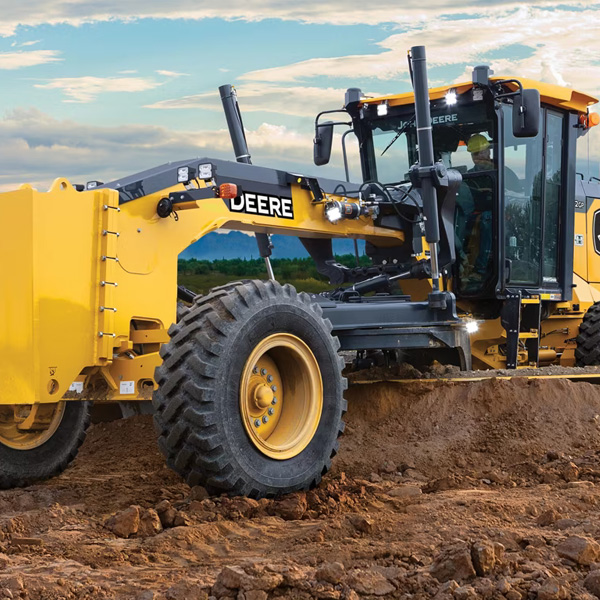
A pipeline survey is the process of measuring, mapping, and documenting the exact route a pipeline follows, including its horizontal position, vertical profile, and relationship to property lines and easements. A licensed land surveyor captures survey-grade coordinates along the corridor so engineers can design the line, contractors can build it in the right place, and operators can locate and maintain it for decades. In Louisiana's oil and gas country, this work spans gathering lines, transmission lines, and the access easements that connect wellheads to processing facilities.
Pipeline surveys come in distinct phases. A route or alignment survey establishes the centerline and the width of the right-of-way before construction. During the build, construction staking marks the trench, bends, and crossings on the ground. After installation, an as-built survey records where the pipe actually went into the earth — essential data because the in-place location often differs slightly from the plan. Each phase produces a permanent record that follows the asset through its operating life.
For energy operators working across Acadiana and the Gulf Coast, Pioneer Surveying provides this corridor mapping using RTK GNSS receivers and aerial methods that keep crews productive even on long, remote lines.
What Is a Wellhead Survey and Who Needs One?
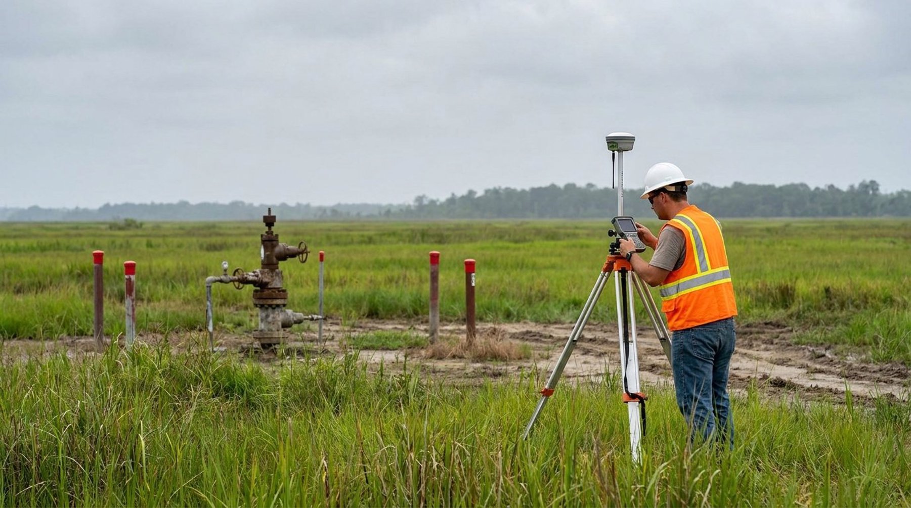
A wellhead survey determines the precise surface coordinates and ground elevation of an oil, gas, or injection well. Operators need this data to file accurate plats with the Louisiana Office of Conservation, to satisfy permitting requirements, and to maintain a defensible record of where the well sits relative to lease lines and unit boundaries. A surveyed wellhead location ties the well to a known geodetic datum so it can be found and verified years later.
Anyone drilling, operating, or decommissioning a well in South Louisiana typically requires a wellhead survey. Exploration and production companies need it for regulatory compliance and unit mapping. Midstream firms use it to plan the gathering lines that tie wells into a system. When a well is plugged and abandoned, a final location survey documents the site for the state record. Because Louisiana's coastal and marsh terrain shifts and floods, an accurately surveyed and monumented wellhead is often the only reliable way to relocate a site after years of subsidence or vegetation change.
The Pipeline and Wellhead Survey Process
The process begins with research and ends with a certified deliverable that operators can rely on for permitting and construction. While every project differs, most follow a predictable sequence that balances field measurement with deed and easement research.
Research and Control
The surveyor first gathers existing records — deeds, prior surveys, easement documents, and state plats — then establishes survey control tied to the Louisiana State Plane Coordinate System. This control framework, set with RTK GNSS receivers referencing known monuments, ensures every later measurement shares the same accurate basis. Solid control is what lets a corridor surveyed in segments across Lafayette Parish and Vermilion Parish stitch together seamlessly.
Field Data Collection
Crews then collect the field data: the wellhead location, the pipeline centerline, existing utilities, drainage features, and property corners along the route. On open corridors, drone photogrammetry and laser scanning capture terrain and obstructions across miles of right-of-way far faster than a ground crew. Tight or wooded sites still call for a robotic total station and boots on the ground. The two approaches are usually blended on a single project.
Mapping and Certification
Back in the office, the surveyor processes the data into a route map, profile, and legal description, then certifies the plat. The deliverable typically includes coordinates, bearings and distances, easement widths, and any encroachments discovered. This certified record becomes the document of reference for engineers, regulators, and landowners alike.
Why Accurate Survey Data Matters in Louisiana's Oil and Gas Corridors
Accurate pipeline and wellhead data protects safety, budget, and legal standing. A right-of-way mapped even a few feet off can place a trench on a neighbor's land, clip a wetland buffer, or conflict with an existing utility — problems that surface mid-construction when correction is most expensive. Precise as-built coordinates also feed the one-call locating system, helping prevent the strikes that cause the most serious pipeline incidents.
South Louisiana adds challenges that demand experienced crews. Much of Acadiana and the coastal zone sits on soft, saturated soils prone to subsidence, and marsh corridors flood seasonally. Monuments heave, settle, and disappear under water and vegetation. Surveyors plan for this by setting durable, well-referenced control, recording redundant ties, and using aerial methods where ground access is poor. Regulatory scrutiny is real too: lines crossing waterways, wetlands, or parish roads near New Iberia, Broussard, or Opelousas often require survey documentation for permits from multiple agencies.
How Pipeline Surveys Compare to Other Survey Types
A pipeline survey is a corridor-focused effort, while most other surveys focus on a single parcel. A topographic survey maps elevations and features within a defined area; a boundary survey establishes a property's legal lines. A pipeline or wellhead survey borrows from both — it needs boundary and easement research to confirm the right-of-way is legal, and topographic detail to design the line's profile and crossings — but it stretches across many parcels and ownerships in a single project.
That breadth is why aerial methods matter so much in pipeline work. Surveying ten miles of corridor parcel-by-parcel with a ground crew alone would take weeks; combining drone photogrammetry for the open stretches with targeted ground survey at crossings and tie-ins delivers the same survey-grade result in a fraction of the time. The right mix depends on terrain, vegetation, and how much existing utility congestion the route must navigate.
Get a Pipeline or Wellhead Survey in Acadiana
If you are planning a new line, permitting a well, or documenting existing assets across South Louisiana and the Gulf Coast, an accurate survey is the foundation everything else is built on. Pioneer Surveying serves operators throughout Lafayette, New Iberia, Opelousas, and the surrounding Acadiana region with corridor mapping, wellhead location, and as-built services. Call (337) 443-0955 or contact our office to discuss your project and request a quote.
Frequently Asked Questions
What is a pipeline survey and who needs one?
A pipeline survey maps the exact route, elevation, and legal easements of a pipeline corridor. Energy operators, midstream companies, and engineering firms need one to design, permit, build, and maintain pipelines safely and in compliance with regulations.
What is a wellhead survey?
A wellhead survey establishes the precise surface coordinates and elevation of an oil, gas, or injection well. The data is required for permitting, for filing accurate plats with the Louisiana Office of Conservation, and for maintaining a reliable as-built record of the well's location.
How accurate are pipeline surveys?
With RTK GNSS and robotic total stations tied to the Louisiana State Plane Coordinate System, modern pipeline surveys routinely achieve horizontal accuracy within a few hundredths of a foot at control points. Drone photogrammetry across open corridors delivers survey-grade results suitable for design and permitting.
Can drones be used for pipeline surveying in Louisiana?
Yes. Drone photogrammetry and laser scanning are well suited to long pipeline corridors and remote wellhead sites across the Gulf Coast, capturing terrain and obstructions far faster than ground crews. Tight or wooded areas are still surveyed with a total station, and the two methods are typically combined.
How long does a pipeline or wellhead survey take?
A single wellhead location survey can often be completed in a day, while a multi-mile pipeline corridor may take from several days to a few weeks depending on length, terrain, and easement research. Aerial methods can significantly shorten fieldwork on open routes in Acadiana and South Louisiana.