
Key Takeaways
- A property line dispute is best resolved with a professional boundary survey, which uses recorded deeds, plats, and physical monuments to legally establish where your property ends and your neighbor's begins.
- In Lafayette Parish and across Acadiana, disputes often arise from old fences, encroaching structures, and vague deed descriptions inherited from decades-old land divisions.
- A licensed surveyor's boundary survey is the evidence courts and title companies rely on — informal agreements or memory of "where the fence has always been" carry little legal weight.
- Identifying easements and encroachments early prevents costly construction delays and protects your property value before you build, buy, or sell.
Few things sour a relationship with a neighbor faster than a disagreement over where one property ends and another begins. Whether it's a new fence, a driveway that seems to cross the line, or a shed built too close to the edge, property line disputes are among the most common — and most emotionally charged — issues landowners face in Lafayette and throughout South Louisiana. The good news is that these conflicts have a clear, professional resolution: a licensed boundary survey.
How Does a Boundary Survey Resolve a Property Line Dispute?
A boundary survey resolves a property line dispute by legally re-establishing the exact location of your property's corners and lines using recorded deeds, subdivision plats, and physical monuments in the ground. A licensed land surveyor measures and reconciles this evidence to produce a defensible determination of where the boundary actually sits — the standard courts, title companies, and insurers accept.
The process begins in the courthouse, not the field. A surveyor researches the chain of title, recorded plats, and adjoining property descriptions filed with the Lafayette Parish Clerk of Court. These documents describe your parcel in metes and bounds or by reference to a recorded subdivision. Discrepancies between neighboring deeds — where two descriptions overlap or leave a gap — are frequently the root cause of a dispute.
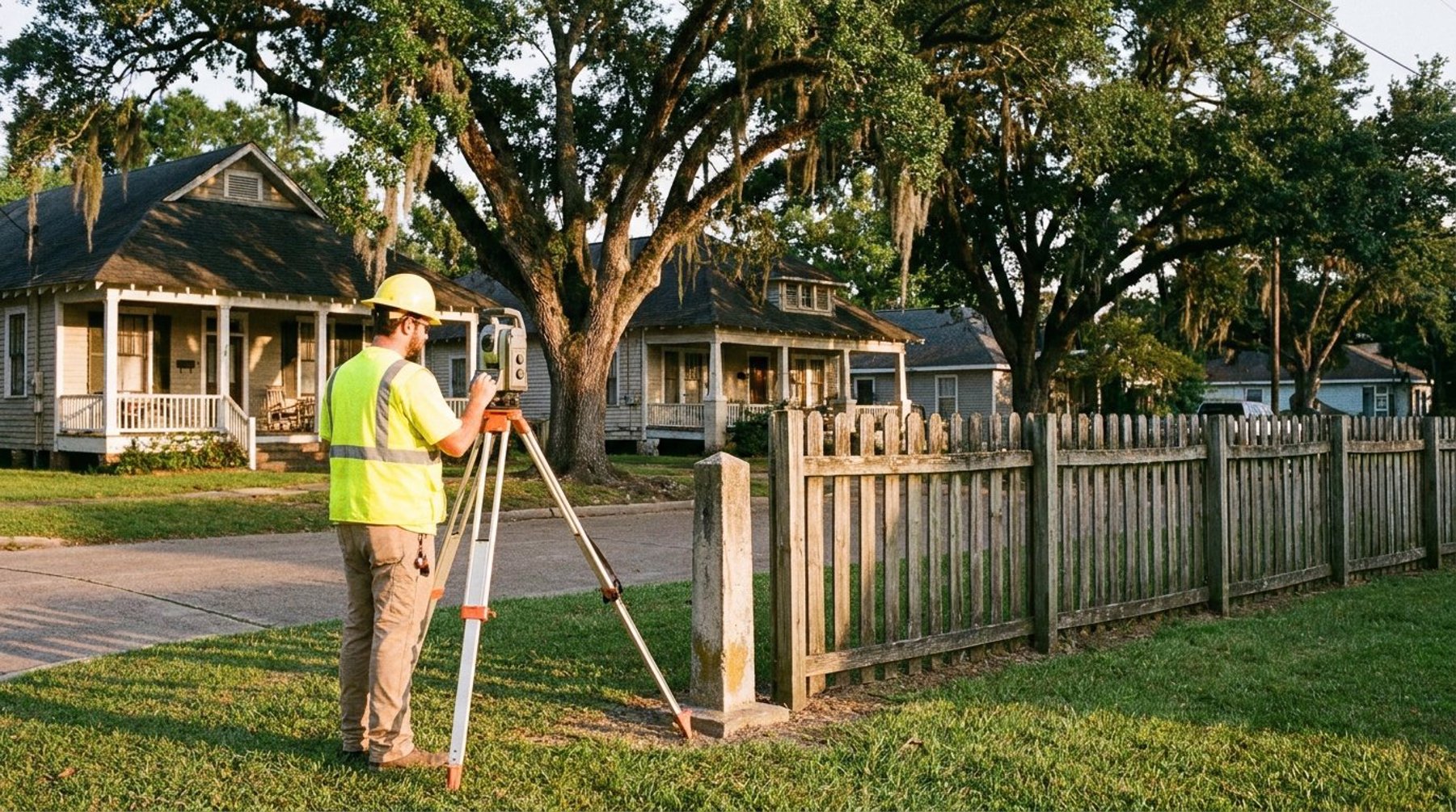
Next, the surveyor locates existing monuments: iron rods, pipes, concrete markers, or other physical evidence set by previous surveyors. Using RTK GNSS receivers and a robotic total station, the crew measures these points to survey-grade accuracy, then compares the field measurements against the record documents. Where monuments are missing or disturbed, the surveyor reconstructs the corners based on the best available evidence and professional judgment guided by Louisiana boundary law.
Common Causes of Property Line Disputes in Acadiana
Most property line disputes in Lafayette, Broussard, and Youngsville trace back to a handful of recurring problems. Understanding these causes helps property owners recognize a dispute early — before it escalates into a legal or financial headache.
Old Fences and "Possession" Lines
A fence built decades ago is one of the most common triggers. Owners often assume the fence marks the true boundary, but fences are frequently placed for convenience rather than surveyed accuracy. In South Louisiana, where many neighborhoods were subdivided from larger agricultural tracts, a fence line may sit several feet off the recorded property line. When a new owner or a survey reveals the discrepancy, a dispute follows.
Vague or Conflicting Deed Descriptions
Older deeds in Acadiana sometimes describe boundaries using landmarks that no longer exist — a "large oak," a drainage ditch that has since been rerouted, or a distance measured from a road that has been widened. These ambiguous descriptions can cause neighboring deeds to overlap or conflict, and only a professional survey can reconcile them.
Encroaching Structures
Sheds, driveways, pools, and additions built without a survey can unintentionally cross a boundary. An encroachment discovered during a real estate transaction can stall closing, complicate title insurance, and force expensive corrective action if it isn't addressed properly.
Easements, Encroachments, and What a Survey Reveals
A thorough boundary survey does more than mark corners — it identifies easements and encroachments that affect how you can use your land. An easement grants another party the right to use part of your property, such as a utility company's power line corridor or a shared drainage servitude, and these rights stay with the land even when ownership changes.
In Louisiana, servitudes (the state's civil-law term for easements) are especially important because drainage and utility corridors are widespread across the flat Acadiana terrain. A survey plots the location of recorded servitudes so you know exactly where you can and cannot build. Discovering a utility servitude after pouring a foundation is a mistake no property owner wants to make.
Encroachments work in both directions. Your neighbor's structure may cross onto your land, or yours may cross onto theirs. A survey documents the exact extent of any encroachment, giving both parties the factual basis they need to negotiate a resolution — whether that's a boundary agreement, a servitude, or removal of the offending structure.
Why Professional Survey Evidence Matters Legally
When a property line dispute reaches a title company, an attorney, or a courtroom, only a survey signed and sealed by a Louisiana-licensed Professional Land Surveyor carries legal weight. Informal agreements, memories of where a fence used to stand, or a neighbor's assurance are not evidence a court can rely on to quiet title or resolve a boundary.
Louisiana boundary law recognizes a clear hierarchy of evidence: recorded monuments and calls generally take precedence over measured distances, and original survey intent governs where records conflict. Applying this hierarchy correctly requires professional training and licensure. A surveyor's sealed plat becomes the authoritative document that title insurers accept, that attorneys cite, and that courts use to establish the legal boundary once and for all.
This is why acting early pays off. A boundary survey completed before you build a fence, purchase a lot, or list a home for sale can prevent a dispute entirely. When a conflict already exists, that same survey becomes the tool that ends it — often without ever needing to go to court.
Resolving a Dispute the Right Way in Lafayette Parish
The most effective path through a property line dispute is straightforward: hire a licensed surveyor, let them complete the research and fieldwork, and use their sealed findings as the basis for resolution. Most disputes are settled once both neighbors see the same objective evidence.
At Pioneer Surveying, our crews use RTK GNSS receivers, robotic total stations, and thorough courthouse research to deliver boundary determinations property owners across Lafayette, Scott, Carencro, and New Iberia can rely on. When needed, we prepare sealed plats suitable for title work, real estate closings, and legal proceedings. If a dispute involves easements or potential encroachments, we document them clearly so you can make informed decisions before spending money on construction.
If you're facing a boundary question or simply want certainty before you build or buy, explore our surveying services or contact our office at 337-443-0955. A boundary survey is a modest investment that protects one of your most valuable assets — and your peace of mind.
How much does a boundary survey cost in Lafayette, LA?
The cost of a boundary survey in Lafayette depends on the size of the property, the complexity of the deed records, the terrain, and how many corners must be located or reset. Small residential lots with clear records cost less than large or heavily wooded tracts with conflicting descriptions. Contact Pioneer Surveying at 337-443-0955 for an accurate quote based on your specific parcel.
Can I use an old survey to settle a property line dispute?
An old survey can be a helpful starting point, but it may not reflect current monuments, recent subdivisions, or changes to adjoining properties. Courts and title companies generally require a current, sealed survey from a licensed surveyor to resolve an active dispute. A new survey verifies that the original corners still exist and are in the correct position.
What is the difference between a boundary survey and a fence line?
A fence line simply marks where a physical fence was built, which is often a matter of convenience and may sit feet away from the true property line. A boundary survey establishes the legal property line using recorded deeds, plats, and monuments measured to survey-grade accuracy. A fence has no legal authority to define a boundary on its own.
Do I need a survey before building a fence in Louisiana?
Yes — a boundary survey before building a fence protects you from accidentally encroaching on a neighbor's land or a utility servitude. Building on the wrong line can force you to remove and rebuild the fence at your own expense. A survey provides the exact corner locations you need to place a fence correctly the first time.