Key Takeaways
- A subdivision survey divides a single parcel of land into multiple legally defined lots and produces a recorded plat — the legal document that creates new property boundaries in Lafayette Parish.
- The process involves boundary research, field survey, lot layout design, drainage and utility easement planning, and parish or municipal plat approval before lots can be sold or built on.
- In Louisiana, only a Professional Land Surveyor (PLS) licensed by the state can prepare and certify a subdivision plat for recording.
- Subdivision survey timelines in Acadiana typically run several weeks to a few months depending on lot count, drainage requirements, and the approval body involved.
What Is a Subdivision Survey?
A subdivision survey is the process of dividing one tract of land into two or more smaller lots, each with its own legally defined boundaries, and producing a recorded plat that makes those new lots official. It is the foundational survey behind every residential neighborhood, commercial development, and family land split in Lafayette and across Acadiana. Without a properly platted and recorded subdivision survey, new lots cannot be legally sold, mortgaged, or permitted for construction.
The plat itself is a precise scaled drawing showing each lot's dimensions, bearings, area, street rights-of-way, and easements. Once approved by the appropriate governing body and recorded with the parish clerk of court, the plat becomes the legal description that title companies, lenders, and the assessor rely on. A subdivision survey is far more involved than a simple boundary survey because it creates new legal parcels rather than retracing existing ones.
The Subdivision Survey Process Step by Step
A subdivision survey follows a defined sequence: boundary establishment, topographic and feature data collection, lot design, easement and drainage planning, plat preparation, and approval and recording. Each stage builds on the last, and skipping or rushing any step can stall approval or create title problems down the road.
1. Boundary and Title Research
The surveyor first establishes the outer boundary of the parent tract by researching deeds, prior surveys, and recorded plats, then locating physical monuments and corners in the field. This perimeter must be airtight, because every new interior lot line is derived from it. In older parts of Lafayette Parish, conflicting historical deed calls are common, so this research phase often determines how smoothly the rest of the project goes.
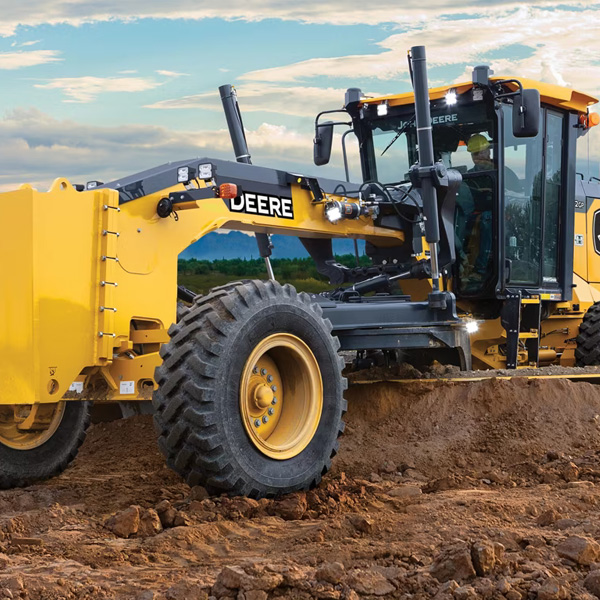
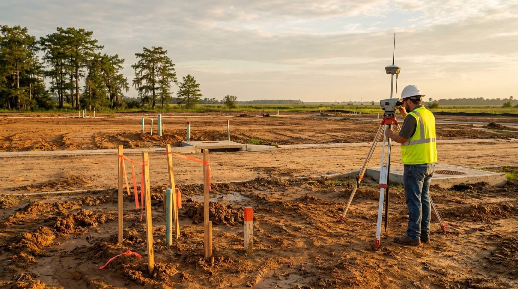
2. Field Survey and Topographic Data
Crews collect precise measurements using RTK GNSS receivers and robotic total stations, and on larger tracts, drone photogrammetry captures terrain and existing features quickly. This data supports drainage design and helps the engineer and surveyor position lots to drain properly — a critical concern in flat, low-lying South Louisiana.
3. Lot Layout and Easement Design
The surveyor lays out individual lots to meet local minimum lot size, frontage, and setback requirements, while reserving rights-of-way for streets and easements for utilities and drainage. Servitudes (Louisiana's term for easements) for sewer, water, electric, and drainage are drawn directly onto the plat so future homeowners and utility providers have clear legal access.
4. Plat Preparation, Approval, and Recording
Once the layout is finalized, the surveyor prepares the formal plat, certifies it, and submits it to the reviewing authority — the Lafayette Consolidated Government planning division, a municipal body in towns like Broussard, Youngsville, or Scott, or the parish for unincorporated areas. After approval, the plat is recorded with the clerk of court, officially creating the new lots.
Major Subdivisions vs. Minor (Family) Splits
Not every land division requires the same level of review. Most jurisdictions in Acadiana distinguish between minor subdivisions — typically dividing a tract into a small number of lots with existing road frontage — and major subdivisions that create new streets, drainage systems, and many lots. Minor splits, often used for family land transfers in places like Carencro, Scott, and rural Lafayette Parish, move through a simpler administrative review.
Major subdivisions trigger a more rigorous process involving preliminary and final plat stages, engineered drainage and infrastructure plans, and sometimes public hearings. Knowing which category your project falls into early on helps you budget realistically for both time and cost. A licensed surveyor familiar with local ordinances can tell you which path applies before you commit to a development plan.
Why Subdivision Surveys Matter in South Louisiana
Drainage and flood considerations make subdivision work especially demanding in Acadiana. Because much of the region sits at low elevation with high water tables, parish and municipal reviewers scrutinize how a new subdivision will handle stormwater. Lots must be graded and laid out so runoff does not flood neighbors or overwhelm existing systems, and many plats must show finished floor elevations relative to the Base Flood Elevation.
Getting this right protects the developer from costly redesigns and protects future homeowners from flood and drainage disputes. It also intersects with FEMA flood zone requirements — properties in Special Flood Hazard Areas may need elevation documentation as part of the platting and permitting process. This is where local surveying experience pays off: firms that work in Lafayette Parish every day understand exactly what reviewers expect.
How Long Does a Subdivision Survey Take and What Affects Cost?
A minor subdivision in Acadiana can often be completed in a few weeks, while a major subdivision with new infrastructure can take several months from field work through final approval. The biggest timeline drivers are the number of lots, drainage and infrastructure complexity, and the review schedule of the approving body.
Cost depends on the same factors plus the size and terrain of the parent tract. A two-lot family split is a modest, predictable expense, whereas a multi-phase residential development with engineered streets and drainage represents a significant investment. The most reliable way to budget is to request a scoped quote based on your specific tract and goals rather than relying on per-lot rules of thumb.
Working With Pioneer Surveying
Pioneer Surveying handles subdivision platting throughout Lafayette, Broussard, Youngsville, and the wider Acadiana region, combining modern RTK GNSS and drone technology with deep knowledge of local subdivision ordinances and Louisiana recording requirements. Whether you are splitting family land or developing a new neighborhood, having a licensed Professional Land Surveyor manage the plat from research through recording keeps your project on schedule and your titles clean.
If you are planning a land division in South Louisiana, reach out to discuss your project. Call (337) 443-0955 or visit our contact page to get started, and explore our full range of surveying services to see how we support developers and property owners across the Gulf Coast.
What does a subdivision survey include in Lafayette, LA?
A subdivision survey includes boundary research and establishment of the parent tract, field measurement and topographic data collection, design of individual lots with proper frontage and setbacks, layout of street rights-of-way and utility and drainage servitudes, and preparation of a certified plat for parish or municipal approval and recording.
Who can legally prepare a subdivision plat in Louisiana?
Only a Professional Land Surveyor (PLS) licensed by the State of Louisiana can prepare, certify, and seal a subdivision plat for recording. The surveyor's certification is what allows the plat to be approved by the local governing authority and recorded with the parish clerk of court.
What is the difference between a minor and major subdivision?
A minor subdivision typically divides a tract into a small number of lots that already have road frontage and existing utilities, moving through a simplified administrative review. A major subdivision creates new streets, drainage systems, and many lots, requiring preliminary and final plat stages, engineered infrastructure plans, and a more rigorous approval process.
How long does a subdivision survey take in Acadiana?
A minor or family land split in Acadiana can often be completed in a few weeks, while a major subdivision with new streets and drainage may take several months from field work through final approval and recording. Lot count, drainage complexity, and the approving body's review schedule are the main factors that affect the timeline.
Do I need a subdivision survey to sell off part of my land?
Yes. To legally sell, mortgage, or build on a portion of a larger tract, that portion must be established as its own lot through a recorded subdivision plat prepared by a licensed surveyor. Selling an unplatted division can create title defects and prevent buyers from obtaining financing or building permits.